


crête du longet

oliviergau
User
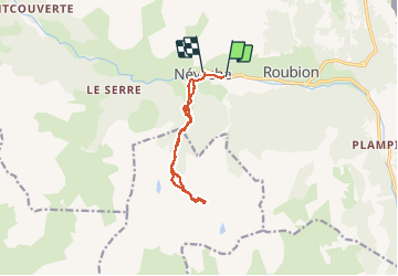

Length
10.6 km

Max alt
2513 m

Uphill gradient
917 m
Km-Effort
23 km

Min alt
1594 m

Downhill gradient
907 m
Boucle
No
Creation date :
2020-02-25 07:25:15.747
Updated on :
2020-02-25 14:06:58.398
4h59
Difficulty : Very easy

FREE GPS app for hiking
 SityTrail
IGN / Geographical institutes
SityTrail Plus
The world is yours!
About
Trail Touring skiing of 10.6 km to be discovered at Provence-Alpes-Côte d'Azur, Hautes-Alpes, Névache. This trail is proposed by oliviergau.
Positioning
Country:
France
Region :
Provence-Alpes-Côte d'Azur
Department/Province :
Hautes-Alpes
Municipality :
Névache
Location:
Unknown
Start:(Dec)
Start:(UTM)
311788 ; 4987737 (32T) N.
Comments