


Ste Maxime - Chapelle St Donnat - Le Revest

ETMU5496
User
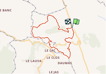

Length
18.8 km

Max alt
372 m

Uphill gradient
716 m
Km-Effort
28 km

Min alt
87 m

Downhill gradient
715 m
Boucle
Yes
Creation date :
2020-02-26 07:51:28.0
Updated on :
2020-03-02 09:14:58.977
4h25
Difficulty : Medium

FREE GPS app for hiking
 SityTrail
IGN / Geographical institutes
SityTrail Plus
The world is yours!
About
Trail Walking of 18.8 km to be discovered at Provence-Alpes-Côte d'Azur, Var, Sainte-Maxime. This trail is proposed by ETMU5496.
Description
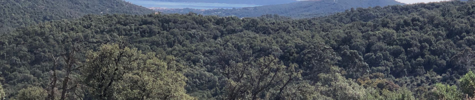
Belle randonnée au coeur du massif des Maures.
Une jolie grimpette en fin de parcours
Photos


Positioning
Country:
France
Region :
Provence-Alpes-Côte d'Azur
Department/Province :
Var
Municipality :
Sainte-Maxime
Location:
Unknown
Start:(Dec)
Start:(UTM)
304642 ; 4806148 (32T) N.
Comments