


collonget fev20

gillesmanfredi
User
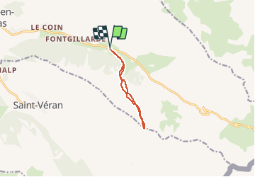

Length
8.2 km

Max alt
2705 m

Uphill gradient
682 m
Km-Effort
17.3 km

Min alt
2022 m

Downhill gradient
681 m
Boucle
Yes
Creation date :
2020-02-29 07:54:26.694
Updated on :
2020-02-29 12:33:00.214
4h37
Difficulty : Very easy

FREE GPS app for hiking
 SityTrail
IGN / Geographical institutes
SityTrail Plus
The world is yours!
About
Trail Touring skiing of 8.2 km to be discovered at Provence-Alpes-Côte d'Azur, Hautes-Alpes, Molines-en-Queyras. This trail is proposed by gillesmanfredi.
Positioning
Country:
France
Region :
Provence-Alpes-Côte d'Azur
Department/Province :
Hautes-Alpes
Municipality :
Molines-en-Queyras
Location:
Unknown
Start:(Dec)
Start:(UTM)
333990 ; 4953866 (32T) N.
Comments