


Du Châtelet vers Gris Nez

michelcortvrint
User

Length
5.7 km

Max alt
54 m

Uphill gradient
78 m
Km-Effort
6.7 km

Min alt
6 m

Downhill gradient
78 m
Boucle
Yes
Creation date :
2020-02-29 13:52:00.0
Updated on :
2020-02-29 15:26:51.756
1h27
Difficulty : Easy

FREE GPS app for hiking
 SityTrail
IGN / Geographical institutes
SityTrail Plus
The world is yours!
About
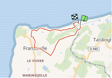
Trail Walking of 5.7 km to be discovered at Hauts-de-France, Pas-de-Calais, Tardinghen. This trail is proposed by michelcortvrint.
Positioning
Country:
France
Region :
Hauts-de-France
Department/Province :
Pas-de-Calais
Municipality :
Tardinghen
Location:
Unknown
Start:(Dec)
Start:(UTM)
402705 ; 5636450 (31U) N.
Comments