


montclut

nordan
User
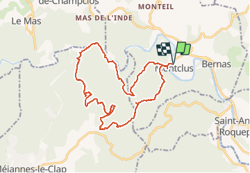

Length
21 km

Max alt
323 m

Uphill gradient
628 m
Km-Effort
29 km

Min alt
85 m

Downhill gradient
628 m
Boucle
Yes
Creation date :
2020-03-01 08:30:16.595
Updated on :
2020-03-01 14:43:42.235
6h03
Difficulty : Very easy

FREE GPS app for hiking
 SityTrail
IGN / Geographical institutes
SityTrail Plus
The world is yours!
About
Trail Walking of 21 km to be discovered at Occitania, Gard, Montclus. This trail is proposed by nordan.
Positioning
Country:
France
Region :
Occitania
Department/Province :
Gard
Municipality :
Montclus
Location:
Unknown
Start:(Dec)
Start:(UTM)
613379 ; 4901992 (31T) N.
Comments