


Tete de ferret

pawenger
User
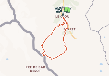

Length
12.2 km

Max alt
2700 m

Uphill gradient
1165 m
Km-Effort
28 km

Min alt
1621 m

Downhill gradient
1166 m
Boucle
Yes
Creation date :
2014-12-10 00:00:00.0
Updated on :
2014-12-10 00:00:00.0
4h00
Difficulty : Medium

FREE GPS app for hiking
 SityTrail
IGN / Geographical institutes
SityTrail Plus
The world is yours!
About
Trail Winter sports of 12.2 km to be discovered at Valais/Wallis, Entremont, Orsières. This trail is proposed by pawenger.
Description
Ski de rando
Positioning
Country:
Switzerland
Region :
Valais/Wallis
Department/Province :
Entremont
Municipality :
Orsières
Location:
Unknown
Start:(Dec)
Start:(UTM)
352500 ; 5087544 (32T) N.
Comments