


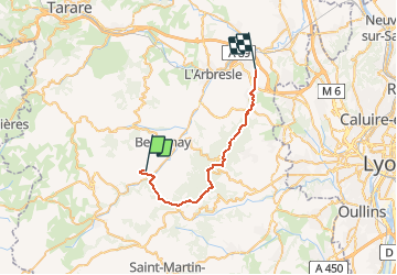
J6 - Monts du lyonnais - Brussieu > Lentilly

aeldin
User

Length
27 km

Max alt
859 m

Uphill gradient
855 m
Km-Effort
39 km

Min alt
276 m

Downhill gradient
993 m
Boucle
No
Creation date :
2020-03-03 17:43:12.19
Updated on :
2020-06-19 15:37:35.13
--
Difficulty : Very easy
--
Difficulty : Very easy

FREE GPS app for hiking
 SityTrail
IGN / Geographical institutes
SityTrail Plus
The world is yours!
About
Trail Fishing of 27 km to be discovered at Auvergne-Rhône-Alpes, Rhône, Brussieu. This trail is proposed by aeldin.

Positioning
Country:
France
Region :
Auvergne-Rhône-Alpes
Department/Province :
Rhône
Municipality :
Brussieu
Location:
Unknown
Start:(Dec)
Start:(UTM)
619202 ; 5067549 (31T) N.
Comments