


z Bagnols 03-03-20

cb8310
User

Length
7.2 km

Max alt
343 m

Uphill gradient
109 m
Km-Effort
8.7 km

Min alt
296 m

Downhill gradient
111 m
Boucle
Yes
Creation date :
2020-03-03 13:07:48.967
Updated on :
2020-03-04 08:44:15.498
2h05
Difficulty : Very easy

FREE GPS app for hiking
 SityTrail
IGN / Geographical institutes
SityTrail Plus
The world is yours!
About
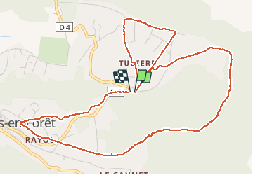
Trail Walking of 7.2 km to be discovered at Provence-Alpes-Côte d'Azur, Var, Bagnols-en-Forêt. This trail is proposed by cb8310.
Description
randonnée tout au tour de Bagnols en forêt sans aucune difficulté
Photos


Positioning
Country:
France
Region :
Provence-Alpes-Côte d'Azur
Department/Province :
Var
Municipality :
Bagnols-en-Forêt
Location:
Unknown
Start:(Dec)
Start:(UTM)
315292 ; 4823363 (32T) N.
Comments