


pourcieux_mont aurelien_l'olympe

bernir
User
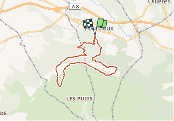

Length
15.2 km

Max alt
874 m

Uphill gradient
715 m
Km-Effort
25 km

Min alt
395 m

Downhill gradient
715 m
Boucle
Yes
Creation date :
2020-03-04 18:26:38.58
Updated on :
2020-11-04 20:34:44.545
5h04
Difficulty : Difficult

FREE GPS app for hiking
 SityTrail
IGN / Geographical institutes
SityTrail Plus
The world is yours!
About
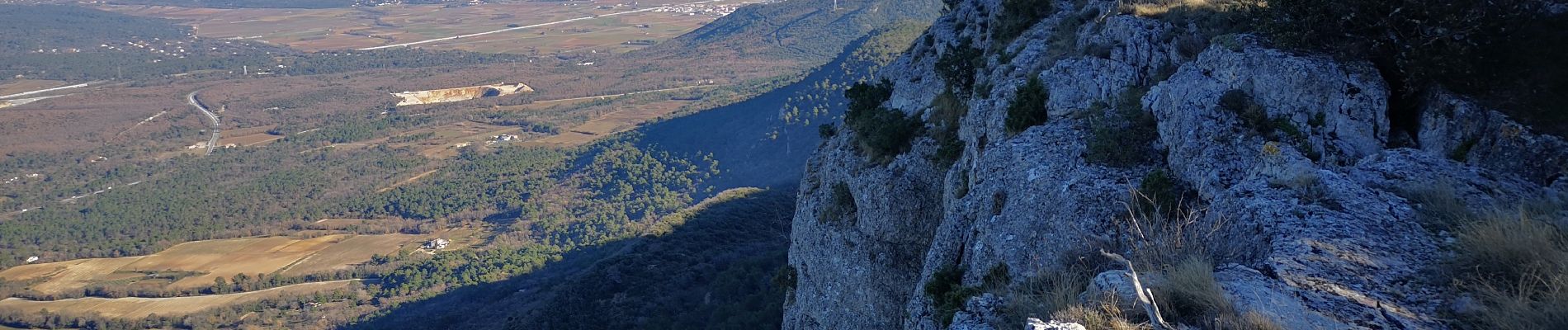
Trail Walking of 15.2 km to be discovered at Provence-Alpes-Côte d'Azur, Var, Pourcieux. This trail is proposed by bernir.
Photos


Positioning
Country:
France
Region :
Provence-Alpes-Côte d'Azur
Department/Province :
Var
Municipality :
Pourcieux
Location:
Unknown
Start:(Dec)
Start:(UTM)
725161 ; 4816312 (31T) N.
Comments