


La pou???

PascalBanide
User
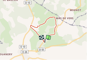

Length
5.1 km

Max alt
283 m

Uphill gradient
53 m
Km-Effort
5.8 km

Min alt
251 m

Downhill gradient
54 m
Boucle
Yes
Creation date :
2020-03-08 14:53:52.0
Updated on :
2020-03-08 16:08:24.231
1h12
Difficulty : Unknown

FREE GPS app for hiking
 SityTrail
IGN / Geographical institutes
SityTrail Plus
The world is yours!
About
Trail Walking of 5.1 km to be discovered at Occitania, Lot, Lalbenque. This trail is proposed by PascalBanide.
Positioning
Country:
France
Region :
Occitania
Department/Province :
Lot
Municipality :
Lalbenque
Location:
Unknown
Start:(Dec)
Start:(UTM)
385208 ; 4911472 (31T) N.
Comments