


chap-1

gilbert57
User
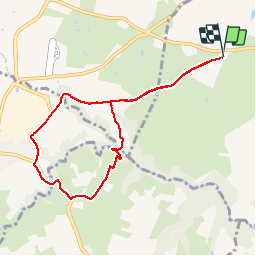

Length
8.1 km

Max alt
316 m

Uphill gradient
128 m
Km-Effort
9.8 km

Min alt
252 m

Downhill gradient
128 m
Boucle
Yes
Creation date :
2014-12-10 00:00:00.0
Updated on :
2014-12-10 00:00:00.0
1h53
Difficulty : Unknown

FREE GPS app for hiking
 SityTrail
IGN / Geographical institutes
SityTrail Plus
The world is yours!
About
Trail Walking of 8.1 km to be discovered at Auvergne-Rhône-Alpes, Rhône, Chaponost. This trail is proposed by gilbert57.
Positioning
Country:
France
Region :
Auvergne-Rhône-Alpes
Department/Province :
Rhône
Municipality :
Chaponost
Location:
Unknown
Start:(Dec)
Start:(UTM)
634356 ; 5063341 (31T) N.
Comments