


Saint amans Soult

nanard31
User

Length
16.4 km

Max alt
956 m

Uphill gradient
753 m
Km-Effort
26 km

Min alt
277 m

Downhill gradient
757 m
Boucle
No
Creation date :
2020-03-14 08:25:52.67
Updated on :
2020-03-14 12:52:52.875
4h25
Difficulty : Very easy

FREE GPS app for hiking
 SityTrail
IGN / Geographical institutes
SityTrail Plus
The world is yours!
About
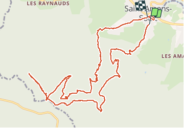
Trail Walking of 16.4 km to be discovered at Occitania, Tarn, Saint-Amans-Soult. This trail is proposed by nanard31.
Positioning
Country:
France
Region :
Occitania
Department/Province :
Tarn
Municipality :
Saint-Amans-Soult
Location:
Unknown
Start:(Dec)
Start:(UTM)
458682 ; 4813710 (31T) N.
Comments