


Canaple par les Cottaves - Chartreuse

GOHIER
User
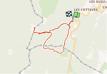

Length
8.3 km

Max alt
1687 m

Uphill gradient
552 m
Km-Effort
15.7 km

Min alt
1129 m

Downhill gradient
559 m
Boucle
Yes
Creation date :
2020-03-14 11:24:48.0
Updated on :
2020-03-14 15:41:01.37
4h14
Difficulty : Difficult

FREE GPS app for hiking
 SityTrail
IGN / Geographical institutes
SityTrail Plus
The world is yours!
About
Trail Touring skiing of 8.3 km to be discovered at Auvergne-Rhône-Alpes, Isère, Saint-Pierre-de-Chartreuse. This trail is proposed by GOHIER.
Description
Ski sanglier au retour mais super balade!
Positioning
Country:
France
Region :
Auvergne-Rhône-Alpes
Department/Province :
Isère
Municipality :
Saint-Pierre-de-Chartreuse
Location:
Unknown
Start:(Dec)
Start:(UTM)
717055 ; 5021016 (31T) N.
Comments