


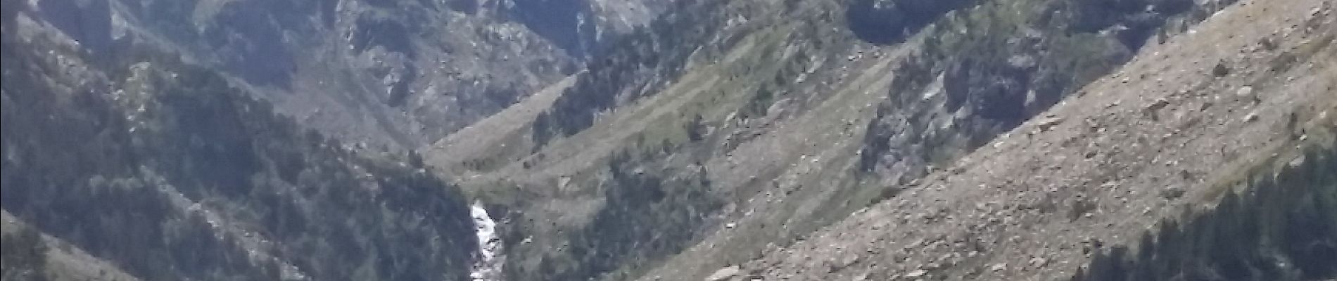
cascade pont d Espagne lac de Gaube Cauterets

Doffémont Laurent
User
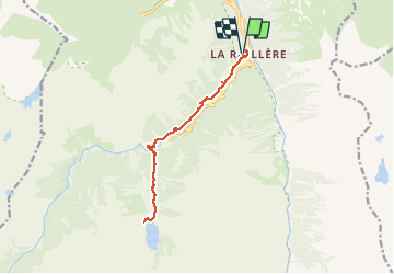

Length
14.7 km

Max alt
1747 m

Uphill gradient
829 m
Km-Effort
26 km

Min alt
1046 m

Downhill gradient
817 m
Boucle
Yes
Creation date :
2020-03-15 12:44:15.493
Updated on :
2020-03-15 12:46:49.359
--
Difficulty : Difficult

FREE GPS app for hiking
 SityTrail
IGN / Geographical institutes
SityTrail Plus
The world is yours!
About
Trail On foot of 14.7 km to be discovered at Occitania, Hautespyrenees, Cauterets. This trail is proposed by Doffémont Laurent.
Photos

Positioning
Country:
France
Region :
Occitania
Department/Province :
Hautespyrenees
Municipality :
Cauterets
Location:
Unknown
Start:(Dec)
Start:(UTM)
735991 ; 4750791 (30T) N.
Comments