


Soum de Lagette 001

mitch1952
User
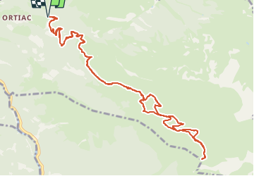

Length
14.3 km

Max alt
2014 m

Uphill gradient
1215 m
Km-Effort
31 km

Min alt
797 m

Downhill gradient
1216 m
Boucle
Yes
Creation date :
2020-03-15 13:23:30.002
Updated on :
2022-06-07 09:45:54.469
6h01
Difficulty : Very difficult

FREE GPS app for hiking
 SityTrail
IGN / Geographical institutes
SityTrail Plus
The world is yours!
About
Trail Walking of 14.3 km to be discovered at Occitania, Hautespyrenees, Villelongue. This trail is proposed by mitch1952.
Positioning
Country:
France
Region :
Occitania
Department/Province :
Hautespyrenees
Municipality :
Villelongue
Location:
Unknown
Start:(Dec)
Start:(UTM)
741513 ; 4759591 (30T) N.
Comments