


vlessrt

Airelle
User
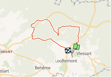

Length
13.2 km

Max alt
517 m

Uphill gradient
252 m
Km-Effort
16.6 km

Min alt
432 m

Downhill gradient
251 m
Boucle
No
Creation date :
2020-03-16 12:08:05.497
Updated on :
2020-03-16 12:17:28.714
4h32
Difficulty : Very difficult

FREE GPS app for hiking
 SityTrail
IGN / Geographical institutes
SityTrail Plus
The world is yours!
About
Trail Walking of 13.2 km to be discovered at Wallonia, Luxembourg, Léglise. This trail is proposed by Airelle.
Positioning
Country:
Belgium
Region :
Wallonia
Department/Province :
Luxembourg
Municipality :
Léglise
Location:
Léglise
Start:(Dec)
Start:(UTM)
689579 ; 5519088 (31U) N.
Comments