


fau cuchet

ascq
User
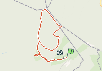

Length
5.1 km

Max alt
1363 m

Uphill gradient
214 m
Km-Effort
7.9 km

Min alt
1151 m

Downhill gradient
208 m
Boucle
Yes
Creation date :
2020-03-16 15:30:23.631
Updated on :
2020-03-16 17:17:01.978
1h46
Difficulty : Very easy

FREE GPS app for hiking
 SityTrail
IGN / Geographical institutes
SityTrail Plus
The world is yours!
About
Trail Walking of 5.1 km to be discovered at Auvergne-Rhône-Alpes, Isère, Saint-Georges-de-Commiers. This trail is proposed by ascq.
Positioning
Country:
France
Region :
Auvergne-Rhône-Alpes
Department/Province :
Isère
Municipality :
Saint-Georges-de-Commiers
Location:
Unknown
Start:(Dec)
Start:(UTM)
716067 ; 4990961 (31T) N.
Comments