Trail Walking Porte-des-Bonnevaux - Les étangs de Nantoin  - Photo
© OpenStreetMap contributors
Length
Length
12.6 km
Max alt
Max alt
622 m
Uphill gradient
Uphill gradient
199 m
Km-Effort
Km-Effort  
15.2 km
Min alt
Min alt
556 m
Downhill gradient
Downhill gradient
198 m
Boucle
Boucle
Yes
Creation date :
2020-03-17 08:53:20.0
Updated on :
2020-03-17 13:59:29.554

(0 Reviews)

Walking
Walking
5h04
Difficulty : Difficult

Scan this QR Code to open this trail in the SityTrail application

FREE GPS app for hiking

Logo SityTrail SityTrail

IGN / Geographical institutes

Download SityTrail from the App Store Download SityTrail from Google Play

Logo SityTrail SityTrail World

The world is yours!

Download SityTrail from the App Store Download SityTrail from Google Play Download SityTrail on Huawei AppGallery

About

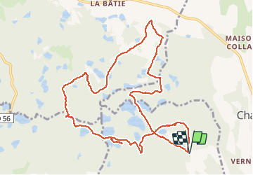
Trail Walking of 12.6 km to be discovered at Auvergne-Rhône-Alpes, Isère, Porte-des-Bonnevaux. This trail is proposed by mireillemarmonier.

Description

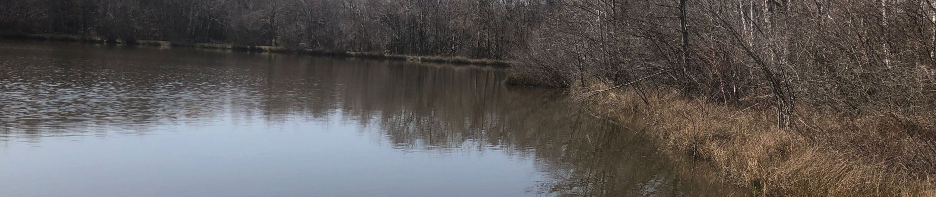
Joli circuit fait par une journée de printemps.
Cependant, quelques passages « ludiques « .
Chemins défoncés par les engins forestiers, beaucoup de boue, sentiers inondés et parfois complètement entravés par les arbres abattus.!!!

Elevation profile

Photos

Positioning

Country:
France
Region :
Auvergne-Rhône-Alpes
Department/Province :
Isère
Municipality :
Porte-des-Bonnevaux
Location:
Nantoin
Start:(UTM)
677816 ; 5035323 (31T) N.

Trails nearby

Trail Walking Champier - Nantoin - Photo
Walking
lilloue

Walking

Difficult
Champier, Auvergne-Rhône-Alpes, Isère, France
10.5 km | 13 km-effort
3h 19min
No
Trail Quad Gillonnay - Sortie Quad - Photo
Quad
Mickey 38

Quad

Gillonnay, Auvergne-Rhône-Alpes, Isère, France
11.9 km | 14.2 km-effort
1h 10min
No
Trail Walking Flachères - RS-La Forêt du Roi - Photo
Walking
raymondfn

Walking

Easy
Flachères, Auvergne-Rhône-Alpes, Isère, France
5.8 km | 6.9 km-effort
1h 12min
Yes
Trail Walking Flachères - La Forêt du Roi - Photo
Walking
raymondfn

Walking

Easy
Flachères, Auvergne-Rhône-Alpes, Isère, France
10.3 km | 13.1 km-effort
3h 15min
Yes
Trail Mountain bike Champier - champier - Photo
Mountain bike
jdesandj

Mountain bike

Difficult
Champier, Auvergne-Rhône-Alpes, Isère, France
42 km | 53 km-effort
3h 0min
No
Trail Mountain bike Eclose-Badinières - Eclose - Photo
Mountain bike
magyar

Mountain bike

Very easy
Eclose-Badinières, Auvergne-Rhône-Alpes, Isère, France
16.4 km | 20 km-effort
Unknown
No
Trail Walking Flachères - RS-Flachères-les brosses - Photo
Walking
dan48

Walking

Easy
(1)
Flachères, Auvergne-Rhône-Alpes, Isère, France
4.1 km | 5 km-effort
1h 8min
Yes
Trail Walking Eydoche - SityTrail - Eydoche 2 - Photo
Walking
raymondfn

Walking

Easy
Eydoche, Auvergne-Rhône-Alpes, Isère, France
4.7 km | 5.3 km-effort
1h 12min
No
Trail Walking Eydoche - SityTrail - Eydoche artisan - Photo
Walking
raymondfn

Walking

Medium
(1)
Eydoche, Auvergne-Rhône-Alpes, Isère, France
6 km | 7 km-effort
1h 35min
No


Close
My subscriptions