


Lockdown day 😊

seghth
User
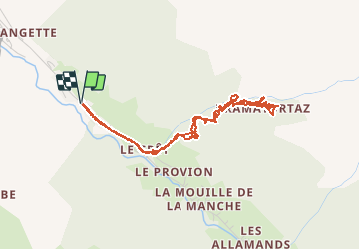

Length
4.9 km

Max alt
1591 m

Uphill gradient
519 m
Km-Effort
11.8 km

Min alt
1064 m

Downhill gradient
520 m
Boucle
Yes
Creation date :
2020-03-17 13:55:13.542
Updated on :
2020-03-17 17:13:33.424
2h37
Difficulty : Very easy

FREE GPS app for hiking
 SityTrail
IGN / Geographical institutes
SityTrail Plus
The world is yours!
About
Trail Walking of 4.9 km to be discovered at Auvergne-Rhône-Alpes, Upper Savoy, Morzine. This trail is proposed by seghth.
Description
Boucle le long du torrent
Positioning
Country:
France
Region :
Auvergne-Rhône-Alpes
Department/Province :
Upper Savoy
Municipality :
Morzine
Location:
Unknown
Start:(Dec)
Start:(UTM)
324164 ; 5114651 (32T) N.
Comments