


limites

olivieraron
User

Length
16.3 km

Max alt
81 m

Uphill gradient
220 m
Km-Effort
19.2 km

Min alt
22 m

Downhill gradient
225 m
Boucle
No
Creation date :
2020-03-20 12:25:28.807
Updated on :
2020-03-20 12:28:26.459
31m
Difficulty : Easy

FREE GPS app for hiking
 SityTrail
IGN / Geographical institutes
SityTrail Plus
The world is yours!
About
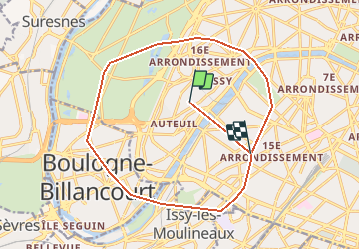
Trail Walking of 16.3 km to be discovered at Ile-de-France, Paris, Paris. This trail is proposed by olivieraron.

Positioning
Country:
France
Region :
Ile-de-France
Department/Province :
Paris
Municipality :
Paris
Location:
16th Arrondissement
Start:(Dec)
Start:(UTM)
446583 ; 5411321 (31U) N.
Comments