


beure - chapelle des buis - fort Fontain

eltonnermou
User
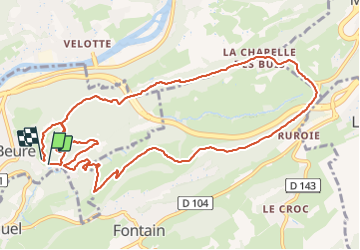

Length
13 km

Max alt
494 m

Uphill gradient
414 m
Km-Effort
18.5 km

Min alt
255 m

Downhill gradient
408 m
Boucle
Yes
Creation date :
2020-03-20 12:55:28.326
Updated on :
2025-01-03 19:38:54.604
4h12
Difficulty : Difficult

FREE GPS app for hiking
 SityTrail
IGN / Geographical institutes
SityTrail Plus
The world is yours!
About
Trail Walking of 13 km to be discovered at Bourgogne-Franche-Comté, Doubs, Beure. This trail is proposed by eltonnermou.
Description
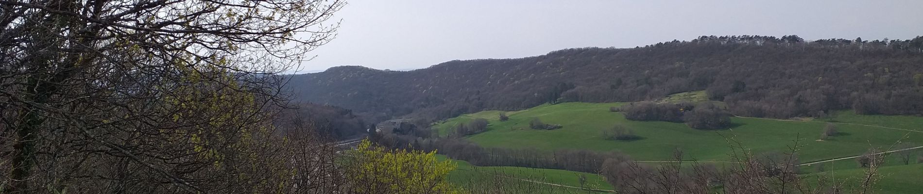
un beau parcours à travers prairies et bois, de beaux points de vue tout au long du parcours et pour finir par une voie celtique ou romaine avec les traces des chariots dans la roche.
Photos


Positioning
Country:
France
Region :
Bourgogne-Franche-Comté
Department/Province :
Doubs
Municipality :
Beure
Location:
Unknown
Start:(Dec)
Start:(UTM)
273318 ; 5232529 (32T) N.
Comments