Trail Walking Cognin-les-Gorges - Les gorges du Nan - Photo
 crocau
crocau

User

© OpenStreetMap contributors
Length
Length
4.8 km
Max alt
Max alt
760 m
Uphill gradient
Uphill gradient
497 m
Km-Effort
Km-Effort  
11.4 km
Min alt
Min alt
282 m
Downhill gradient
Downhill gradient
496 m
Boucle
Boucle
Yes
Creation date :
2020-03-21 18:07:52.215
Updated on :
2020-04-03 22:12:23.814

(0 Reviews)

Walking
Walking
2h13
Difficulty : Medium

Scan this QR Code to open this trail in the SityTrail application

FREE GPS app for hiking

Logo SityTrail SityTrail

IGN / Geographical institutes

Download SityTrail from the App Store Download SityTrail from Google Play

Logo SityTrail SityTrail World

The world is yours!

Download SityTrail from the App Store Download SityTrail from Google Play Download SityTrail on Huawei AppGallery

About

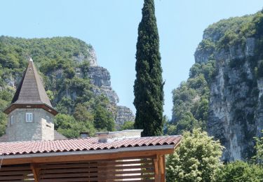
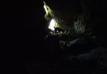
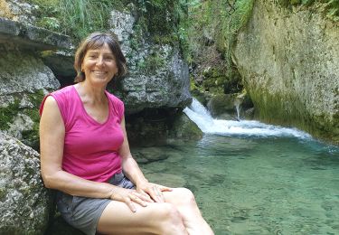
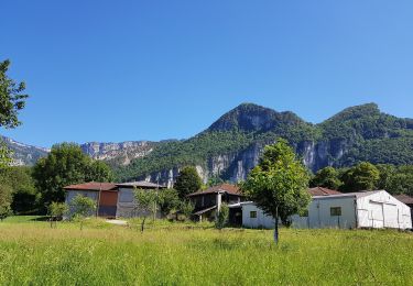
Trail Walking of 4.8 km to be discovered at Auvergne-Rhône-Alpes, Isère, Cognin-les-Gorges. This trail is proposed by crocau.

Description

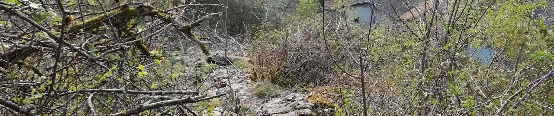
On démarre du village, on longe le ruisseau, le chemin devient plus étroit , se transforme en passerelle le long de la falaise. Ensuite un petit coup de cul tranquille nous éloigne du torrent et nous rapproche de la route. On redescend la d22 , on croise des chamois et après le dernier tunnels on cherche notre chemin à gauche qui va nous permettre de couper plusieurs fois la route. Les points de vue sont partout magnifiques. Ne pas hésiter à faire cette balade en été mais prudence sur la route !

Elevation profile

Photos

31 photos in total. Please click on a photo to see them all in the gallery.

Positioning

Country:
France
Region :
Auvergne-Rhône-Alpes
Department/Province :
Isère
Municipality :
Cognin-les-Gorges
Location:
Unknown
Start:(UTM)
689631 ; 5004572 (31T) N.

Trails nearby

Trail Walking Cognin-les-Gorges - gerlette abs - Photo
Walking
dorane

Walking

Very easy
(1)
Cognin-les-Gorges, Auvergne-Rhône-Alpes, Isère, France
15.8 km | 31 km-effort
7h 12min
Yes
Trail Walking Malleval-en-Vercors - pas du Follet en boucle - Photo
Walking
cmarit

Walking

Medium
(1)
Malleval-en-Vercors, Auvergne-Rhône-Alpes, Isère, France
16.7 km | 26 km-effort
6h 59min
Yes
Trail Mountain bike Vinay - Vinay-Plaine-Pont de Treillins - Photo
Mountain bike
crocau

Mountain bike

Very easy
Vinay, Auvergne-Rhône-Alpes, Isère, France
10 km | 11.7 km-effort
1h 11min
Yes
Trail Walking Malleval-en-Vercors - Patente - Photo
Walking
crocau

Walking

Difficult
Malleval-en-Vercors, Auvergne-Rhône-Alpes, Isère, France
9.9 km | 13.4 km-effort
3h 7min
Yes
Trail Walking Cognin-les-Gorges - Cognin-les-Gorges - Gorges du Nan - Malleval-en-Vercors - Photo
Walking
Philindy26

Walking

Difficult
Cognin-les-Gorges, Auvergne-Rhône-Alpes, Isère, France
15.6 km | 30 km-effort
5h 30min
Yes
Trail Walking Izeron - La lunette- fontaine et grotte de Byry - Photo
Walking
crocau

Walking

Medium
Izeron, Auvergne-Rhône-Alpes, Isère, France
4.8 km | 7.4 km-effort
3h 0min
Yes
Trail Walking Cognin-les-Gorges - Cognin les gorges  - Photo
Walking
Sylvie.P

Walking

Medium
Cognin-les-Gorges, Auvergne-Rhône-Alpes, Isère, France
15.5 km | 30 km-effort
4h 28min
No
Trail Walking Izeron - Monchardon-Gonthier - Photo
Walking
crocau

Walking

Very easy
(1)
Izeron, Auvergne-Rhône-Alpes, Isère, France
6.4 km | 12.1 km-effort
2h 19min
Yes
Trail Walking Rovon - Pied Aigu - Photo
Walking
patjobou

Walking

Difficult
Rovon, Auvergne-Rhône-Alpes, Isère, France
12.4 km | 22 km-effort
5h 19min
Yes


Close
My subscriptions