


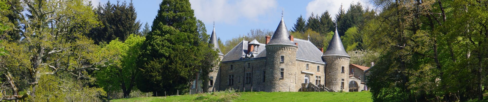
Celles_Puy_Oscot

jagarnier
User GUIDE
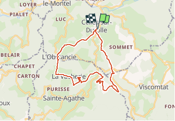

Length
15.2 km

Max alt
884 m

Uphill gradient
506 m
Km-Effort
22 km

Min alt
612 m

Downhill gradient
506 m
Boucle
Yes
Creation date :
2020-04-13 06:50:27.108
Updated on :
2025-05-20 09:59:53.063
5h00
Difficulty : Medium

FREE GPS app for hiking
 SityTrail
IGN / Geographical institutes
SityTrail Plus
The world is yours!
About
Trail Walking of 15.2 km to be discovered at Auvergne-Rhône-Alpes, Puy-de-Dôme, Celles-sur-Durolle. This trail is proposed by jagarnier.
Photos

Positioning
Country:
France
Region :
Auvergne-Rhône-Alpes
Department/Province :
Puy-de-Dôme
Municipality :
Celles-sur-Durolle
Location:
Unknown
Start:(Dec)
Start:(UTM)
549410 ; 5078244 (31T) N.
Comments