


1465

alainphilippe
User
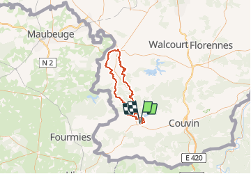

Length
68 km

Max alt
273 m

Uphill gradient
1114 m
Km-Effort
83 km

Min alt
154 m

Downhill gradient
1114 m
Boucle
Yes
Creation date :
2020-04-19 06:41:19.024
Updated on :
2020-04-19 17:42:59.714
18h00
Difficulty : Very difficult
--
Difficulty : Difficult

FREE GPS app for hiking
 SityTrail
IGN / Geographical institutes
SityTrail Plus
The world is yours!
About
Trail Walking of 68 km to be discovered at Wallonia, Hainaut, Chimay. This trail is proposed by alainphilippe.
Points of interest

Positioning
Country:
Belgium
Region :
Wallonia
Department/Province :
Hainaut
Municipality :
Chimay
Location:
Chimay
Start:(Dec)
Start:(UTM)
594760 ; 5545238 (31U) N.
Comments