


vélo route

olivier26
User

Length
67 km

Max alt
403 m

Uphill gradient
659 m
Km-Effort
75 km

Min alt
104 m

Downhill gradient
666 m
Boucle
Yes
Creation date :
2014-12-10 00:00:00.0
Updated on :
2014-12-10 00:00:00.0
2h58
Difficulty : Medium

FREE GPS app for hiking
 SityTrail
IGN / Geographical institutes
SityTrail Plus
The world is yours!
About
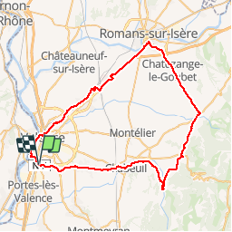
Trail Cycle of 67 km to be discovered at Auvergne-Rhône-Alpes, Drôme, Valence. This trail is proposed by olivier26.
Positioning
Country:
France
Region :
Auvergne-Rhône-Alpes
Department/Province :
Drôme
Municipality :
Valence
Location:
Unknown
Start:(Dec)
Start:(UTM)
649062 ; 4974102 (31T) N.
Comments