


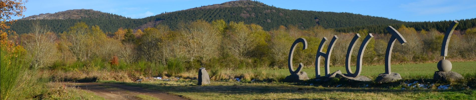
Beauregard_Jumes_Coquille_Gouttes

jagarnier
User GUIDE
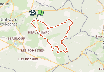

Length
14.7 km

Max alt
1152 m

Uphill gradient
469 m
Km-Effort
21 km

Min alt
875 m

Downhill gradient
470 m
Boucle
Yes
Creation date :
2020-04-25 06:25:18.865
Updated on :
2025-04-24 09:58:17.915
4h30
Difficulty : Difficult

FREE GPS app for hiking
 SityTrail
IGN / Geographical institutes
SityTrail Plus
The world is yours!
About
Trail Walking of 14.7 km to be discovered at Auvergne-Rhône-Alpes, Puy-de-Dôme, Saint-Ours. This trail is proposed by jagarnier.
Photos

Positioning
Country:
France
Region :
Auvergne-Rhône-Alpes
Department/Province :
Puy-de-Dôme
Municipality :
Saint-Ours
Location:
Unknown
Start:(Dec)
Start:(UTM)
494260 ; 5077582 (31T) N.
Comments