


pic d'araing

sga31
User

Length
9.1 km

Max alt
1655 m

Uphill gradient
736 m
Km-Effort
18.9 km

Min alt
922 m

Downhill gradient
721 m
Boucle
Yes
Creation date :
2014-12-10 00:00:00.0
Updated on :
2014-12-10 00:00:00.0
5h43
Difficulty : Unknown

FREE GPS app for hiking
 SityTrail
IGN / Geographical institutes
SityTrail Plus
The world is yours!
About
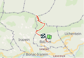
Trail Other activity of 9.1 km to be discovered at Occitania, Ariège, Balacet. This trail is proposed by sga31.
Positioning
Country:
France
Region :
Occitania
Department/Province :
Ariège
Municipality :
Balacet
Location:
Unknown
Start:(Dec)
Start:(UTM)
335217 ; 4749884 (31T) N.
Comments