Trail Walking Saint-Parthem - 2020_07_De la vallée au Château_allongé - Photo

2020_07_De la vallée au Château_allongé

© OpenStreetMap contributors
Length
Length
9.7 km
Max alt
Max alt
381 m
Uphill gradient
Uphill gradient
275 m
Km-Effort
Km-Effort  
13.4 km
Min alt
Min alt
186 m
Downhill gradient
Downhill gradient
282 m
Boucle
Boucle
Yes
Creation date :
2020-04-27 12:24:15.056
Updated on :
2020-04-27 12:26:28.315

(0 Reviews)

Walking
Walking
2h05
Difficulty : Medium

Scan this QR Code to open this trail in the SityTrail application

FREE GPS app for hiking

Logo SityTrail SityTrail

IGN / Geographical institutes

Download SityTrail from the App Store Download SityTrail from Google Play

Logo SityTrail SityTrail World

The world is yours!

Download SityTrail from the App Store Download SityTrail from Google Play Download SityTrail on Huawei AppGallery

About

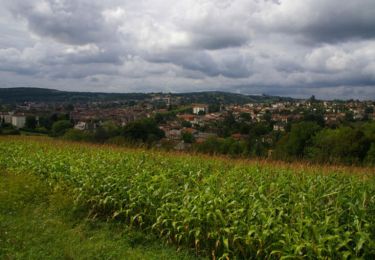
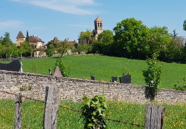
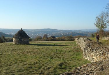
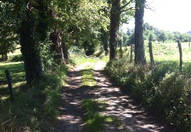
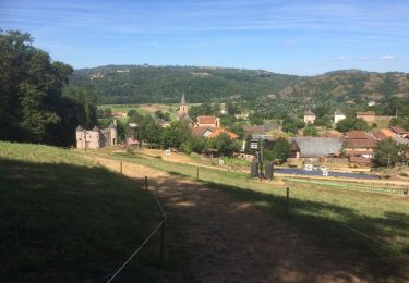
Trail Walking of 9.7 km to be discovered at Occitania, Aveyron, Saint-Parthem. This trail is proposed by jeanlucien.
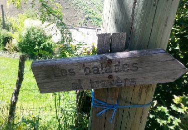
Description

Balisage Jaune
Allongé du point 3 au point 4 (Puech Molaine à Roumégoux)

Elevation profile

Positioning

Country:
France
Region :
Occitania
Department/Province :
Aveyron
Municipality :
Saint-Parthem
Location:
Unknown
Start:(UTM)
441200 ; 4940889 (31T) N.

Trails nearby

Trail Walking Livinhac-le-Haut - Livinhac le Haut - Figeac - Chemin de St-Jacques de Compostelle - Photo
Walking
tracegps

Walking

Very difficult
(4)
Livinhac-le-Haut, Occitania, Aveyron, France
26 km | 33 km-effort
5h 0min
No
Trail Walking Livinhac-le-Haut - Levinhac le Haut Figeac Avril  2018 - Photo
Walking
GUIDE
Kargil

Walking

Medium
Livinhac-le-Haut, Occitania, Aveyron, France
24 km | 31 km-effort
6h 27min
No
Trail Walking Livinhac-le-Haut - Compostelle 12 - Livinhac-le-haut -> Figeac - Photo
Walking
uru2010

Walking

Medium
(1)
Livinhac-le-Haut, Occitania, Aveyron, France
26 km | 33 km-effort
7h 4min
No
Trail Walking Livinhac-le-Haut - CC_Velay_CB_11_Livinhac-Haut_Figeac_20071102 - Photo
Walking
patrickdanilo

Walking

Medium
Livinhac-le-Haut, Occitania, Aveyron, France
26 km | 34 km-effort
6h 40min
No
Trail Walking Livinhac-le-Haut - Livinhac le Haut vers Figeac - Photo
Walking
choubaka77

Walking

Medium
Livinhac-le-Haut, Occitania, Aveyron, France
25 km | 32 km-effort
6h 1min
No
Trail On foot Flagnac - Hier, un village - Photo
On foot
PRO

On foot

Easy
Flagnac, Occitania, Aveyron, France
10.1 km | 13.7 km-effort
3h 7min
Yes
Trail Mountain bike Flagnac - Tour Flagnac - Photo
Mountain bike
j.pont

Mountain bike

Medium
Flagnac, Occitania, Aveyron, France
12 km | 16.3 km-effort
1h 8min
Yes
Trail Mountain bike Flagnac - Livinhac - Photo
Mountain bike
j.pont

Mountain bike

Easy
Flagnac, Occitania, Aveyron, France
11.5 km | 14.3 km-effort
58min
Yes
Trail Walking Boisse-Penchot - boisse penchot-millagues-boisse penchot - Photo
Walking
lascap12

Walking

Medium
Boisse-Penchot, Occitania, Aveyron, France
10.5 km | 14.8 km-effort
2h 43min
Yes


Close
My subscriptions