Trail Walking Saint-Genès-Champespe - 
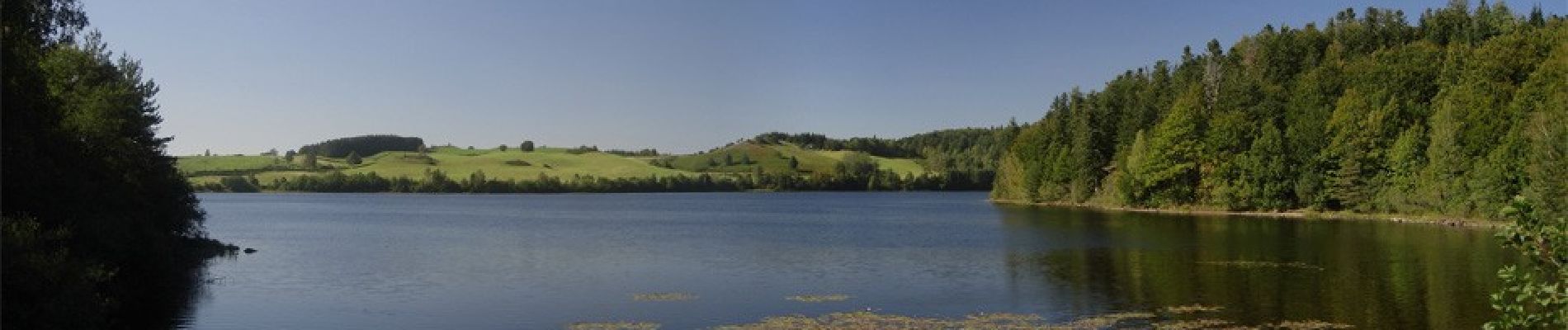
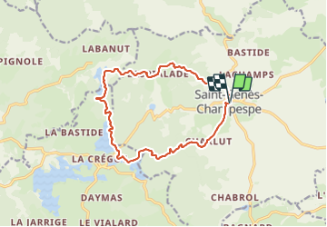
St_Genes_Champespe_Cregut - Photo
 jagarnier
jagarnier

User GUIDE

© OpenStreetMap contributors
Length
Length
14 km
Max alt
Max alt
1021 m
Uphill gradient
Uphill gradient
281 m
Km-Effort
Km-Effort  
17.7 km
Min alt
Min alt
863 m
Downhill gradient
Downhill gradient
280 m
Boucle
Boucle
Yes
Creation date :
2020-04-29 09:43:24.874
Updated on :
2024-06-23 07:55:38.694

(1 Reviews)

Walking
Walking
4h15
Difficulty : Medium

Scan this QR Code to open this trail in the SityTrail application

FREE GPS app for hiking

Logo SityTrail SityTrail

IGN / Geographical institutes

Download SityTrail from the App Store Download SityTrail from Google Play

Logo SityTrail SityTrail Plus

The world is yours!

Download SityTrail from the App Store Download SityTrail from Google Play Download SityTrail on Huawei AppGallery

About

Trail Walking of 14 km to be discovered at Auvergne-Rhône-Alpes, Puy-de-Dôme, Saint-Genès-Champespe. This trail is proposed by jagarnier.

Description

Le relief tourmenté de l'Artense, une alternance de croupes rocheuses, de prairies et de zones humides forment le décor de cette très belle randonnée.
Vous découvrirez les lacs de barrage du Taurons, de la Crégut et du Tact.

Elevation profile

Photos

Positioning

Country:
France
Region :
Auvergne-Rhône-Alpes
Department/Province :
Puy-de-Dôme
Municipality :
Saint-Genès-Champespe
Location:
Unknown
Start:(UTM)
478468 ; 5029469 (31T) N.

Comments

Please log in to post a review or rate the element


merci super


Close
My subscriptions