


Le real

carole5983
User
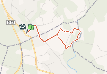

Length
4.2 km

Max alt
218 m

Uphill gradient
91 m
Km-Effort
5.4 km

Min alt
175 m

Downhill gradient
92 m
Boucle
Yes
Creation date :
2020-04-29 14:28:43.875
Updated on :
2020-04-29 16:05:05.546
1h36
Difficulty : Very easy

FREE GPS app for hiking
 SityTrail
IGN / Geographical institutes
SityTrail Plus
The world is yours!
About
Trail Walking of 4.2 km to be discovered at Provence-Alpes-Côte d'Azur, Var, Draguignan. This trail is proposed by carole5983.
Description
Chemins privés
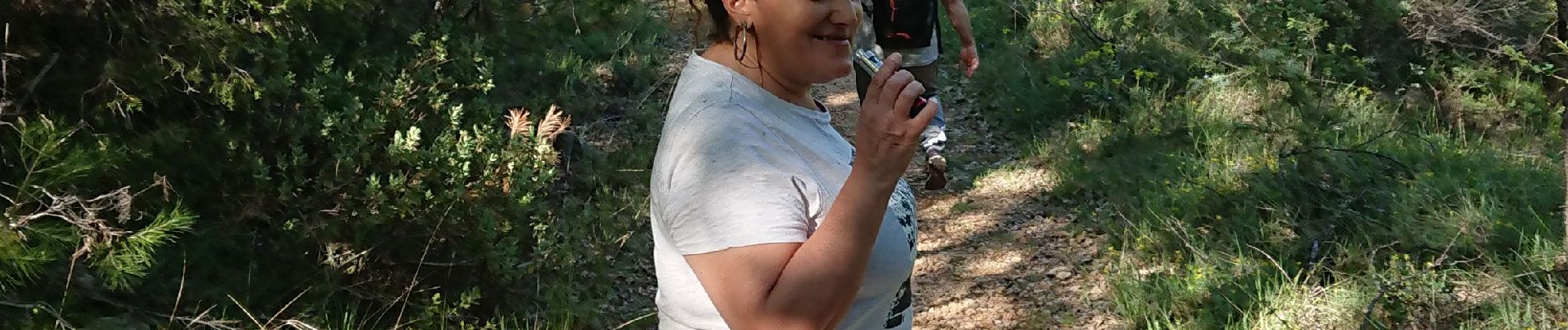
Photos

Positioning
Country:
France
Region :
Provence-Alpes-Côte d'Azur
Department/Province :
Var
Municipality :
Draguignan
Location:
Unknown
Start:(Dec)
Start:(UTM)
292692 ; 4819438 (32T) N.
Comments