


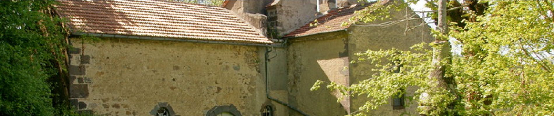
Chateauneuf_St_Valentin

jagarnier
User GUIDE
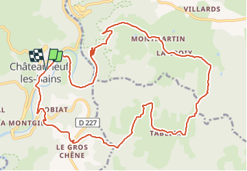

Length
13.4 km

Max alt
712 m

Uphill gradient
435 m
Km-Effort
19.2 km

Min alt
386 m

Downhill gradient
435 m
Boucle
Yes
Creation date :
2020-05-02 07:55:28.93
Updated on :
2023-11-15 11:44:26.477
4h00
Difficulty : Medium

FREE GPS app for hiking
 SityTrail
IGN / Geographical institutes
SityTrail Plus
The world is yours!
About
Trail Walking of 13.4 km to be discovered at Auvergne-Rhône-Alpes, Puy-de-Dôme, Châteauneuf-les-Bains. This trail is proposed by jagarnier.
Photos

Positioning
Country:
France
Region :
Auvergne-Rhône-Alpes
Department/Province :
Puy-de-Dôme
Municipality :
Châteauneuf-les-Bains
Location:
Unknown
Start:(Dec)
Start:(UTM)
492093 ; 5097010 (31T) N.
Comments