


12

YamTof
User
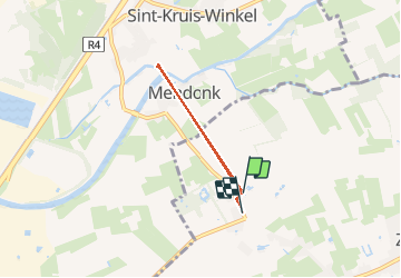

Length
3.6 km

Max alt
9 m

Uphill gradient
18 m
Km-Effort
3.8 km

Min alt
-1 m

Downhill gradient
20 m
Boucle
No
Creation date :
2020-05-02 12:37:49.984
Updated on :
2020-05-02 14:08:03.61
1h29
Difficulty : Very easy

FREE GPS app for hiking
 SityTrail
IGN / Geographical institutes
SityTrail Plus
The world is yours!
About
Trail Walking of 3.6 km to be discovered at Flanders, East Flanders, Lochristi. This trail is proposed by YamTof.
Positioning
Country:
Belgium
Region :
Flanders
Department/Province :
East Flanders
Municipality :
Lochristi
Location:
Zaffelare
Start:(Dec)
Start:(UTM)
558164 ; 5665381 (31U) N.
Comments