


Manzat_Sources_Morge

jagarnier
User GUIDE
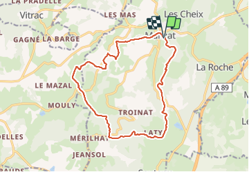

Length
16.1 km

Max alt
902 m

Uphill gradient
466 m
Km-Effort
22 km

Min alt
616 m

Downhill gradient
473 m
Boucle
Yes
Creation date :
2020-05-03 06:10:39.686
Updated on :
2025-05-12 10:09:47.816
4h45
Difficulty : Medium

FREE GPS app for hiking
 SityTrail
IGN / Geographical institutes
SityTrail Plus
The world is yours!
About
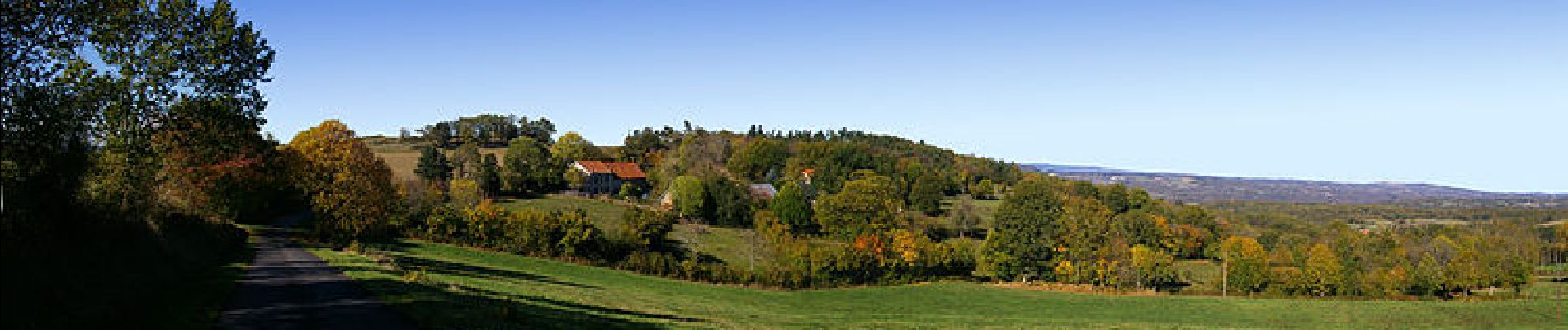
Trail Walking of 16.1 km to be discovered at Auvergne-Rhône-Alpes, Puy-de-Dôme, Manzat. This trail is proposed by jagarnier.
Photos

Positioning
Country:
France
Region :
Auvergne-Rhône-Alpes
Department/Province :
Puy-de-Dôme
Municipality :
Manzat
Location:
Unknown
Start:(Dec)
Start:(UTM)
495564 ; 5089660 (31T) N.
Comments