


Mazaye_Pierre_Chastel

jagarnier
User GUIDE
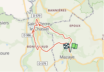

Length
7.3 km

Max alt
743 m

Uphill gradient
183 m
Km-Effort
9.8 km

Min alt
675 m

Downhill gradient
183 m
Boucle
Yes
Creation date :
2020-05-04 09:31:39.771
Updated on :
2023-12-09 11:27:40.863
2h15
Difficulty : Easy

FREE GPS app for hiking
 SityTrail
IGN / Geographical institutes
SityTrail Plus
The world is yours!
About
Trail Walking of 7.3 km to be discovered at Auvergne-Rhône-Alpes, Puy-de-Dôme, Mazaye. This trail is proposed by jagarnier.
Description
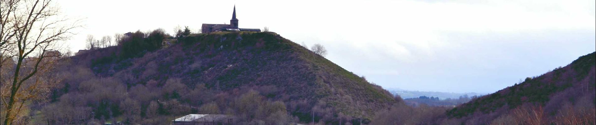
Depuis Mazaye dans sa verdure, vous atteindrez le château de Bonnabaud, puis St-Pierre le Chastel avec son église romane dominant un ancien lac comblé.
Photos

Positioning
Country:
France
Region :
Auvergne-Rhône-Alpes
Department/Province :
Puy-de-Dôme
Municipality :
Mazaye
Location:
Unknown
Start:(Dec)
Start:(UTM)
489213 ; 5070489 (31T) N.
Comments