


quick du 12/5/20

olivieraron
User
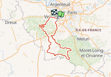

Length
226 km

Max alt
185 m

Uphill gradient
2630 m
Km-Effort
261 km

Min alt
57 m

Downhill gradient
2629 m
Boucle
No
Creation date :
2020-05-05 14:56:12.123
Updated on :
2020-05-05 14:56:12.123

FREE GPS app for hiking
 SityTrail
IGN / Geographical institutes
SityTrail Plus
The world is yours!
About
Trail of 226 km to be discovered at Ile-de-France, Essonne, Bièvres. This trail is proposed by olivieraron.
Positioning
Country:
France
Region :
Ile-de-France
Department/Province :
Essonne
Municipality :
Bièvres
Location:
Unknown
Start:(Dec)
Start:(UTM)
440962 ; 5399764 (31U) N.
Comments