


Rigi Kaltbad UrmibergBrunnen

hrb
User
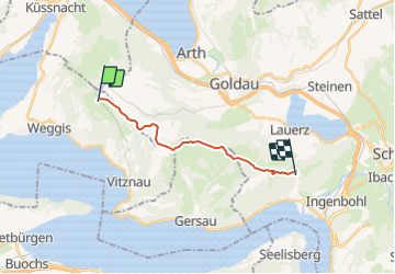

Length
12.5 km

Max alt
1603 m

Uphill gradient
453 m
Km-Effort
19.5 km

Min alt
1141 m

Downhill gradient
726 m
Boucle
No
Creation date :
2014-12-11 00:00:00.0
Updated on :
2014-12-11 00:00:00.0
--
Difficulty : Unknown

FREE GPS app for hiking
 SityTrail
IGN / Geographical institutes
SityTrail Plus
The world is yours!
About
Trail Other activity of 12.5 km to be discovered at Luzern, Unknown, Weggis. This trail is proposed by hrb.
Description
Via les Cernets-Dessous
Positioning
Country:
Switzerland
Region :
Luzern
Department/Province :
Unknown
Municipality :
Weggis
Location:
Unknown
Start:(Dec)
Start:(UTM)
459421 ; 5210142 (32T) N.
Comments