


VB Beriwäg-Varianten

hrb
User
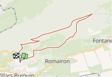

Length
4.6 km

Max alt
1023 m

Uphill gradient
212 m
Km-Effort
7.4 km

Min alt
815 m

Downhill gradient
207 m
Boucle
Yes
Creation date :
2014-12-11 00:00:00.0
Updated on :
2014-12-11 00:00:00.0
--
Difficulty : Unknown

FREE GPS app for hiking
 SityTrail
IGN / Geographical institutes
SityTrail Plus
The world is yours!
About
Trail Other activity of 4.6 km to be discovered at Vaud, District du Jura-Nord vaudois, Tévenon. This trail is proposed by hrb.
Description
Weg von Pt 1123 bzw. 1127 relativ schlecht. Letzte Kurve (nach links aufwärts)im Bois de Cernil la Dame undeutlich.
Positioning
Country:
Switzerland
Region :
Vaud
Department/Province :
District du Jura-Nord vaudois
Municipality :
Tévenon
Location:
Unknown
Start:(Dec)
Start:(UTM)
319260 ; 5191165 (32T) N.
Comments