


BL Blauen (Rodersdorf - Zwingen)

hrb
User
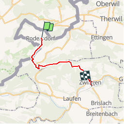

Length
12.9 km

Max alt
878 m

Uphill gradient
578 m
Km-Effort
21 km

Min alt
339 m

Downhill gradient
626 m
Boucle
No
Creation date :
2014-12-11 00:00:00.0
Updated on :
2014-12-11 00:00:00.0
--
Difficulty : Unknown

FREE GPS app for hiking
 SityTrail
IGN / Geographical institutes
SityTrail Plus
The world is yours!
About
Trail Other activity of 12.9 km to be discovered at Solothurn, Bezirk Dorneck, Rodersdorf. This trail is proposed by hrb.
Description
Von burg an ist es stotzig bis zur Challhöhe. Der Gratweg ist schön. Aussichtspunkt auf 800müM
Positioning
Country:
Switzerland
Region :
Solothurn
Department/Province :
Bezirk Dorneck
Municipality :
Rodersdorf
Location:
Unknown
Start:(Dec)
Start:(UTM)
383918 ; 5259760 (32T) N.
Comments