


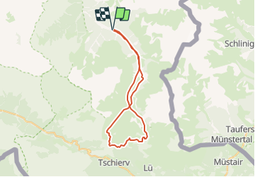
GR S-charl Tamangur Münstertal und zurück

hrb
User

Length
24 km

Max alt
2395 m

Uphill gradient
898 m
Km-Effort
36 km

Min alt
1813 m

Downhill gradient
897 m
Boucle
Yes
Creation date :
2014-12-11 00:00:00.0
Updated on :
2014-12-11 00:00:00.0
--
Difficulty : Unknown

FREE GPS app for hiking
 SityTrail
IGN / Geographical institutes
SityTrail Plus
The world is yours!
About
Trail Other activity of 24 km to be discovered at Grisons, Region Engiadina Bassa/Val Müstair, Scuol. This trail is proposed by hrb.
Description
Von burg an ist es stotzig bis zur Challhöhe. Der Gratweg ist schön. Aussichtspunkt auf 800müM
Positioning
Country:
Switzerland
Region :
Grisons
Department/Province :
Region Engiadina Bassa/Val Müstair
Municipality :
Scuol
Location:
Unknown
Start:(Dec)
Start:(UTM)
602005 ; 5174431 (32T) N.
Comments