


Saint Jean de Beauregard

Lucquiaud
User
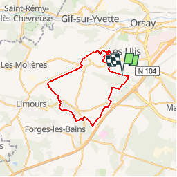

Length
21 km

Max alt
178 m

Uphill gradient
314 m
Km-Effort
26 km

Min alt
109 m

Downhill gradient
319 m
Boucle
Yes
Creation date :
2018-09-15 15:06:49.485
Updated on :
2018-09-15 15:06:49.493
6h26
Difficulty : Medium

FREE GPS app for hiking
 SityTrail
IGN / Geographical institutes
SityTrail Plus
The world is yours!
About
Trail Walking of 21 km to be discovered at Ile-de-France, Essonne, Saint-Jean-de-Beauregard. This trail is proposed by Lucquiaud.
Positioning
Country:
France
Region :
Ile-de-France
Department/Province :
Essonne
Municipality :
Saint-Jean-de-Beauregard
Location:
Unknown
Start:(Dec)
Start:(UTM)
438637 ; 5390500 (31U) N.
Comments
En cours d'acquisition