


tour meteo

lablaquiere
User
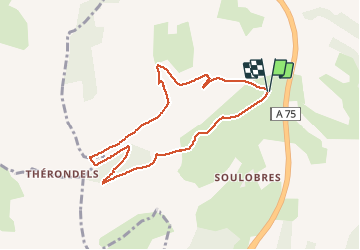

Length
8.2 km

Max alt
708 m

Uphill gradient
270 m
Km-Effort
11.8 km

Min alt
484 m

Downhill gradient
272 m
Boucle
Yes
Creation date :
2020-05-16 12:09:59.358
Updated on :
2020-05-16 13:33:18.824
1h22
Difficulty : Very easy

FREE GPS app for hiking
 SityTrail
IGN / Geographical institutes
SityTrail Plus
The world is yours!
About
Trail Running of 8.2 km to be discovered at Occitania, Aveyron, Millau. This trail is proposed by lablaquiere.
Positioning
Country:
France
Region :
Occitania
Department/Province :
Aveyron
Municipality :
Millau
Location:
Unknown
Start:(Dec)
Start:(UTM)
502105 ; 4885287 (31T) N.
Comments