


blauzac capitelles sagries

Dan30
User
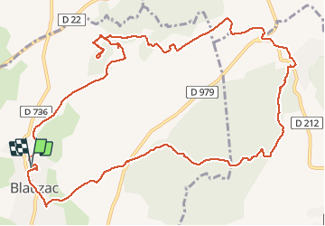

Length
15.6 km

Max alt
164 m

Uphill gradient
274 m
Km-Effort
19.3 km

Min alt
58 m

Downhill gradient
271 m
Boucle
Yes
Creation date :
2020-05-16 08:31:15.989
Updated on :
2020-05-16 13:40:05.817
4h26
Difficulty : Easy

FREE GPS app for hiking
 SityTrail
IGN / Geographical institutes
SityTrail Plus
The world is yours!
About
Trail Walking of 15.6 km to be discovered at Occitania, Gard, Blauzac. This trail is proposed by Dan30.
Positioning
Country:
France
Region :
Occitania
Department/Province :
Gard
Municipality :
Blauzac
Location:
Unknown
Start:(Dec)
Start:(UTM)
609734 ; 4868878 (31T) N.
Comments