


Le Candelon

RANDOTOURVES01
User

Length
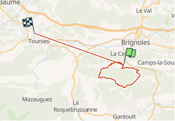
26 km

Max alt
769 m

Uphill gradient
1197 m
Km-Effort
42 km

Min alt
234 m

Downhill gradient
1125 m
Boucle
No
Creation date :
2020-05-17 06:59:54.539
Updated on :
2020-05-17 16:27:06.028
6h47
Difficulty : Medium

FREE GPS app for hiking
 SityTrail
IGN / Geographical institutes
SityTrail Plus
The world is yours!
About
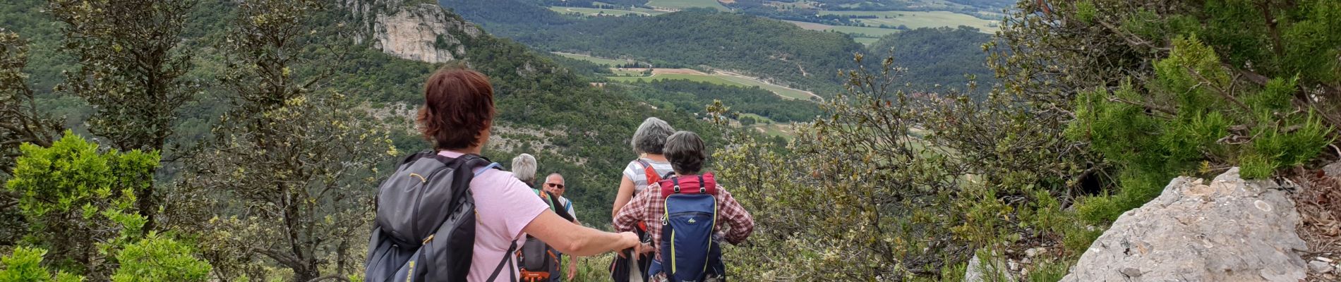
Trail Walking of 26 km to be discovered at Provence-Alpes-Côte d'Azur, Var, Brignoles. This trail is proposed by RANDOTOURVES01.
Photos


Positioning
Country:
France
Region :
Provence-Alpes-Côte d'Azur
Department/Province :
Var
Municipality :
Brignoles
Location:
Unknown
Start:(Dec)
Start:(UTM)
260681 ; 4807710 (32T) N.
Comments