


Chantemelle-Athus

Airelle
User
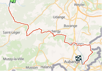

Length
30 km

Max alt
393 m

Uphill gradient
519 m
Km-Effort
37 km

Min alt
267 m

Downhill gradient
584 m
Boucle
No
Creation date :
2020-05-21 07:08:48.0
Updated on :
2020-05-23 09:52:57.303
6h40
Difficulty : Unknown

FREE GPS app for hiking
 SityTrail
IGN / Geographical institutes
SityTrail Plus
The world is yours!
About
Trail Walking of 30 km to be discovered at Wallonia, Luxembourg, Étalle. This trail is proposed by Airelle.
Positioning
Country:
Belgium
Region :
Wallonia
Department/Province :
Luxembourg
Municipality :
Étalle
Location:
Chantemelle
Start:(Dec)
Start:(UTM)
691411 ; 5503515 (31U) N.
Comments