


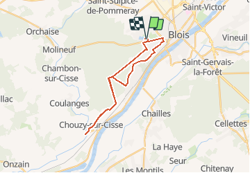
Blois étang de Chouzy

laurence41
User

Length
24 km

Max alt
136 m

Uphill gradient
242 m
Km-Effort
27 km

Min alt
63 m

Downhill gradient
242 m
Boucle
Yes
Creation date :
2020-05-21 16:25:58.534
Updated on :
2020-05-21 16:26:36.899
--
Difficulty : Very easy

FREE GPS app for hiking
 SityTrail
IGN / Geographical institutes
SityTrail Plus
The world is yours!
About
Trail Cycle of 24 km to be discovered at Centre-Loire Valley, Loir-et-Cher, Blois. This trail is proposed by laurence41.
Positioning
Country:
France
Region :
Centre-Loire Valley
Department/Province :
Loir-et-Cher
Municipality :
Blois
Location:
Unknown
Start:(Dec)
Start:(UTM)
372310 ; 5271476 (31T) N.
Comments