


Roc d’Arguille

GOHIER
User
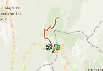

Length
6.1 km

Max alt
1769 m

Uphill gradient
364 m
Km-Effort
11 km

Min alt
1403 m

Downhill gradient
365 m
Boucle
Yes
Creation date :
2020-05-21 09:59:28.0
Updated on :
2020-05-23 09:12:31.141
4h50
Difficulty : Unknown

FREE GPS app for hiking
 SityTrail
IGN / Geographical institutes
SityTrail Plus
The world is yours!
About
Trail Walking of 6.1 km to be discovered at Auvergne-Rhône-Alpes, Isère, Saint-Pierre-de-Chartreuse. This trail is proposed by GOHIER.
Description
AvecDidier Fabienne Alexis et Fred
Positioning
Country:
France
Region :
Auvergne-Rhône-Alpes
Department/Province :
Isère
Municipality :
Saint-Pierre-de-Chartreuse
Location:
Unknown
Start:(Dec)
Start:(UTM)
722202 ; 5020376 (31T) N.
Comments