


2020-05-23 Forêt de Carnelle

Bernardb44
User
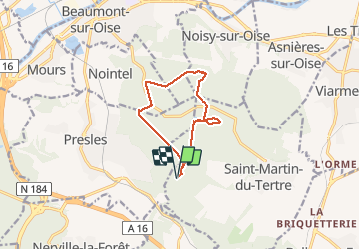

Length
9.2 km

Max alt
218 m

Uphill gradient
213 m
Km-Effort
12 km

Min alt
117 m

Downhill gradient
212 m
Boucle
Yes
Creation date :
2020-05-23 13:13:46.471
Updated on :
2020-05-23 15:34:49.329
2h20
Difficulty : Easy

FREE GPS app for hiking
 SityTrail
IGN / Geographical institutes
SityTrail Plus
The world is yours!
About
Trail Walking of 9.2 km to be discovered at Ile-de-France, Val-d'Oise, Saint-Martin-du-Tertre. This trail is proposed by Bernardb44.
Positioning
Country:
France
Region :
Ile-de-France
Department/Province :
Val-d'Oise
Municipality :
Saint-Martin-du-Tertre
Location:
Unknown
Start:(Dec)
Start:(UTM)
449868 ; 5439489 (31U) N.
Comments