


tuyau 22

laurentnerual
User
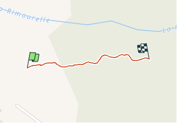

Length
236 m

Max alt
479 m

Uphill gradient
0 m
Km-Effort
262 m

Min alt
467 m

Downhill gradient
8 m
Boucle
No
Creation date :
2020-05-23 15:36:06.947
Updated on :
2020-05-23 15:42:19.74
5m
Difficulty : Very easy

FREE GPS app for hiking
 SityTrail
IGN / Geographical institutes
SityTrail Plus
The world is yours!
About
Trail Walking of 236 m to be discovered at Provence-Alpes-Côte d'Azur, Alpes-de-Haute-Provence, Saint-Michel-l'Observatoire. This trail is proposed by laurentnerual.
Positioning
Country:
France
Region :
Provence-Alpes-Côte d'Azur
Department/Province :
Alpes-de-Haute-Provence
Municipality :
Saint-Michel-l'Observatoire
Location:
Unknown
Start:(Dec)
Start:(UTM)
720150 ; 4865233 (31T) N.
Comments