


le Bois

jmgeffrin
User
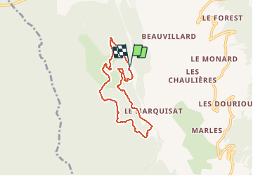

Length
6.7 km

Max alt
1216 m

Uphill gradient
267 m
Km-Effort
10.2 km

Min alt
975 m

Downhill gradient
264 m
Boucle
Yes
Creation date :
2020-05-24 07:42:27.984
Updated on :
2020-05-24 10:13:07.129
2h29
Difficulty : Very easy

FREE GPS app for hiking
 SityTrail
IGN / Geographical institutes
SityTrail Plus
The world is yours!
About
Trail Walking of 6.7 km to be discovered at Provence-Alpes-Côte d'Azur, Hautes-Alpes, Crots. This trail is proposed by jmgeffrin.
Positioning
Country:
France
Region :
Provence-Alpes-Côte d'Azur
Department/Province :
Hautes-Alpes
Municipality :
Crots
Location:
Unknown
Start:(Dec)
Start:(UTM)
297158 ; 4932347 (32T) N.
Comments
Balade livre Guillaine p 47