


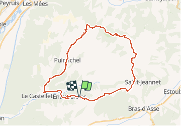
puimichel tour

laurentnerual
User

Length
38 km

Max alt
910 m

Uphill gradient
762 m
Km-Effort
49 km

Min alt
477 m

Downhill gradient
762 m
Boucle
Yes
Creation date :
2020-05-27 10:08:16.034
Updated on :
2020-05-27 16:21:40.353
5h07
Difficulty : Easy

FREE GPS app for hiking
 SityTrail
IGN / Geographical institutes
SityTrail Plus
The world is yours!
About
Trail Mountain bike of 38 km to be discovered at Provence-Alpes-Côte d'Azur, Alpes-de-Haute-Provence, Entrevennes. This trail is proposed by laurentnerual.
Positioning
Country:
France
Region :
Provence-Alpes-Côte d'Azur
Department/Province :
Alpes-de-Haute-Provence
Municipality :
Entrevennes
Location:
Unknown
Start:(Dec)
Start:(UTM)
262204 ; 4869191 (32T) N.
Comments